
Source: National Oceanic and Atmospheric Administration (NOAA), Beyond Ocean Mapping: Using Uncrewed Vehicles to Advance Ocean Research, https://www.fisheries.noaa.gov/feature-story/beyond-ocean-mapping-using-uncrewed-vehicles-advance-ocean-research, published August 20, 2026. This article has been edited for brevity.
Even when traditional research vessels can’t safely reach parts of the ocean, the science doesn’t stop. Uncrewed surface vehicles give scientists access to the ocean with fewer constraints, rewriting what is possible in oceanographic and fisheries research and addressing longstanding research questions.
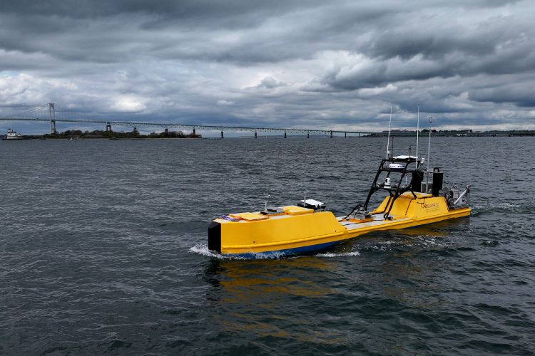
It’s January off of Nantucket Shoals. An uncrewed surface vehicle begins a series of carefully planned transects through Southern New England, collecting data day and night. There are no scientists onboard, but the 30-foot vessel is constantly measuring ocean currents, water temperature, salinity, weather and other ocean conditions. It’s also helping identify areas with high fish and plankton abundance. Every nautical mile traveled adds to a more complete picture of how marine ecosystems function.
These missions reflect NOAA’s growing use of uncrewed systems technology. Traditionally, these autonomous platforms have supported hydrographic surveys, nautical charting, and ocean mapping. But the benefits extend beyond creating better maps. Today, the same technologies are helping scientists answer complex ecological and oceanographic questions. They’re collecting critical, high-accuracy, and time-sensitive data across nearly every mission area.
“Over the last several years, we have been able to expand the applications for how uncrewed surface vehicles can help with various research related to stock, ecosystem, and protected species evaluations and assessments,” explains Dr. Conor McManus, marine development and advanced technology program lead for the Northeast Fisheries Science Center. “With each mission we conduct, we are learning more about the Northeast U.S. Shelf ecosystem, but also how we can better operationalize these technologies to meet our scientific or data needs.”
These technological advances are expanding where, when, and how our scientists collect ocean data. The results allow researchers to observe the ocean more continuously and in places that are difficult to sample with ships alone. These vehicles complement ship-based surveys—filling gaps in data that can arise from challenges like winter weather and limited ship availability.
This year, there were three uncrewed surface vehicle missions in the Northeast—two operated by Chance Maritime Technologies and one [other]. They demonstrated how the benefits of uncrewed survey technology can answer many different scientific questions.
Reaching Places Scientists Can’t Always Go
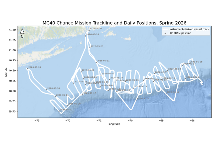
This spring and summer, the science center contracted Chance Maritime Technologies to survey portions of the Mid-Atlantic Bight and George’s Bank. Their high-power MC40 uncrewed surface vehicle spent about 30 days surveying the region, covering approximately 4,500 kilometers. The mission focused on understanding the ocean conditions that create feeding habitat for endangered North Atlantic right whales. As an added bonus, researchers collected sightings of marine mammals and seabirds from boat cameras.
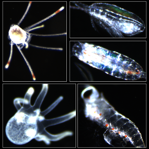
The survey used advanced oceanographic sensors to better understand why zooplankton—tiny drifting animals that form the foundation of the marine food web—aggregate in certain areas. Right whales rely on dense patches of zooplankton for food. Identifying the oceanographic and foraging conditions of these right whale hotspots can improve our understanding of why these animals form consistent, dense aggregations. Scientists observe where these patches occur, but questions remain:
- Why do they form?
- Why do they vary from year to year?
- What ocean conditions help create the dense aggregations on which whales depend?
To help answer those questions, the 40-foot uncrewed surface vehicle was outfitted with a suite of oceanographic and biological sensors:
- Acoustic echosounders
- Acoustic Doppler Current Profiler
- CTD instrumentation
- Plankton imaging via periodic vertical casts
- Algae levels and water clarity
- Meteorological and oceanographic sensors
As it surveyed, it continuously measured:
- Ocean currents
- Water temperature and salinity
- Plankton abundance and species
- Weather and ocean conditions above and below the ocean surface
These observations are giving researchers new insight into the physical processes that shape zooplankton distributions and, ultimately, the feeding habitats of whales.
Funding for this work was provided by NOAA Office of Marine and Aviation Operations’ Uncrewed Systems Operations Center.
Combining New Technology with Traditional Surveys
To improve efficiency while building on ongoing efforts, the Chance mission coordinated NOAA Fisheries’ long-running Ecosystem Monitoring Survey. For more than 40 years, the science center has conducted long-term surveys of the Northeast U.S. Shelf. It is one of the nation’s longest continuous records of changing ocean conditions. “Conducting near-real-time comparisons of our traditional net sampling with new plankton imaging and acoustics collections is a valuable opportunity,” shares Dr. Greg Ellis, oceanographic research analyst with the science center. “It will allow us to see how data from these different methods compare, and help us understand how to improve our data products using these new tools.”
During the spring survey, Chance Maritime coordinated sampling with NOAA Ship Pisces at 14 stations over 2 days. Scientists collected plankton samples using traditional bongo nets and optical instruments. The uncrewed surface vehicle gathered acoustic, oceanographic, and plankton imaging data at the same locations.
Each approach contributes different but complementary information. Net samples collected by scientists show what species are present throughout the entire water column. The uncrewed vehicle can pinpoint the depth where plankton are located, as well as the ocean conditions surrounding them. Understanding that vertical structure is essential—plankton and fish are not evenly distributed with water depth, and those patterns influence where predators, including right whales, find food.
Scientists will be able to gain a clearer understanding of plankton distribution by combining these complementary collection methods. The results will also help improve future autonomous surveys and refine how uncrewed vehicles are integrated into long-term ecosystem monitoring in the Northeast. The work comes at a time of NOAA’s growing investment in autonomous marine technologies. We recently awarded a $21.6 million contract to Chance Maritime Technologies for the purchase of up to eight uncrewed marine systems over the next 5 years.
Advancing Technology for the Future of Ocean Observation
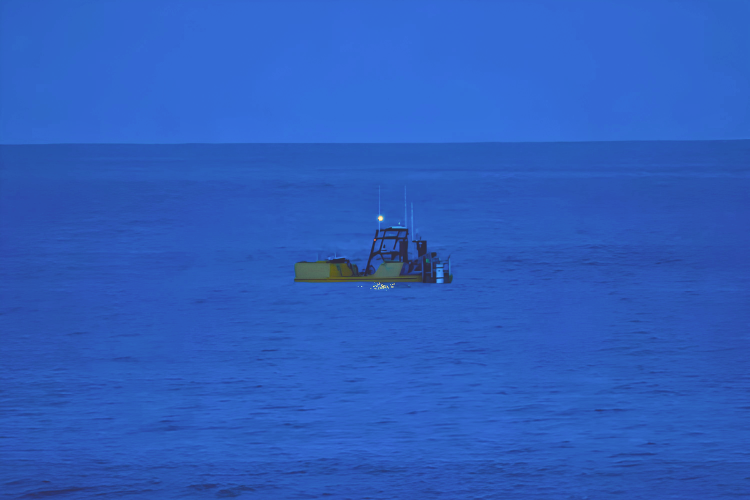
The value of uncrewed surface vehicles extends beyond the data collected during a single mission. Scientists are now designing surveys that combine autonomous vehicles, research vessels, and multiple types of sensors. This will enable us to answer questions that would be difficult for any one platform to address alone. At the same time, NOAA is building the data systems needed to process the large amounts of information these technologies collect. We will be able to turn large datasets into actionable information more quickly.
“Every time we send an uncrewed surface vehicle on a mission, we’re expanding what we can observe and understand about the ocean. By combining this technology with decades of NOAA science, we can fill important data gaps and better track how changing marine ecosystems are impacting the fisheries and protected species that depend on them.”
Dr. Chris Orphanides, the science center’s protected species lead for marine development
From helping scientists understand the feeding habits of North Atlantic right whales to improving fish and plankton monitoring around marine development areas and supporting future fisheries surveys, uncrewed systems are becoming an important part of NOAA’s research toolkit.